Area 51: What You Can See When You Visit
A grounded traveler's guide to the Nevada desert's most famous fence line, separating what is documented from what is claimed.
The Drive
Drive north from Las Vegas long enough and the strip malls give way to Joshua trees, then to nothing at all. State Route 375 runs arrow-straight through the high desert of central Nevada, and for most of its length you will see more cattle than cars. Somewhere beyond a low ridge to the southwest sits the reason people make this drive: a restricted military installation so heavily mythologized that its name has become shorthand for government secrecy itself. You will not see it. What you will see is desert, a warning sign, a diner in Rachel, and a lot of empty road.
Historical Background
The installation sits beside a dry lakebed called Groom Lake, chosen in 1955 for the same qualities that make the drive so empty: isolation, flat terrain suitable for runways, and airspace far from observers. According to declassified CIA records released in 2013, the site was established to flight-test the U-2 reconnaissance aircraft, a high-altitude spy plane developed during the Cold War. The lakebed offered a natural landing surface, and the surrounding Nevada Test and Training Range provided the security perimeter.
Over the following decades, the site tested the A-12 and SR-71 Blackbird programs and, later, stealth aircraft including the F-117 Nighthawk. Aircraft that flew higher, faster, and more invisibly than anything an adversary possessed were worth hiding.
For decades, the U.S. government declined to confirm the facility existed at all. That changed in 2013, when the CIA released documents that publicly acknowledged the site and its role in the U-2 program. The name Area 51 appears on old maps as a numbered grid square of the Nevada Test Site. The government has never used the name officially in the way popular culture does, and the site remains an active, classified installation.
The Legend
The UFO reputation grew out of a collision between secrecy and observation. Through the 1950s and 1960s, commercial pilots and civilians occasionally reported strange lights and objects moving at extreme altitude and speed over Nevada. Many of these sightings, later analysis suggested, coincided with test flights of aircraft the public had no way of knowing existed. A U-2 cruising above 60,000 feet, catching sunlight long after the ground had gone dark, was a rational explanation that the government could not offer without revealing the program.
The modern legend crystallized in 1989. That year, a man named Bob Lazar told a Las Vegas television station that he had worked at a site near Groom Lake called S-4, where he claimed the U.S. government was reverse-engineering craft of extraterrestrial origin. Lazar described antimatter reactors and an element he called Element 115. His claims have never been independently verified, and significant portions of his stated educational and employment history have been disputed. What is not in dispute is the effect of his interview: it transformed a secret airbase into a global symbol of alien contact.
Since then, the folklore has grown to take in stories of crashed saucers, underground levels, and hidden bodies. None of these claims is supported by documented evidence.
Verified Facts vs. Folklore
| Claim | Status |
|---|---|
| The site exists and tests aircraft | Documented. Acknowledged by the CIA in 2013. |
| It was built to fly the U-2 spy plane | Documented in declassified records. |
| It hosted A-12, SR-71, and stealth programs | Documented. |
| Many 1950s to 1960s UFO reports match secret test flights | Supported by later analysis. |
| The government reverse-engineers alien craft there | Unverified claim, originating largely with Bob Lazar in 1989. |
| Underground alien facilities and recovered bodies exist | Folklore. No documented evidence. |
Visiting Information
You cannot enter the base, and the facility is out of sight from every point the public is permitted to stand. You cannot approach the inner perimeter. What you can do is drive the public roads that skirt the enormous restricted zone and visit the small community that grew up alongside the legend.
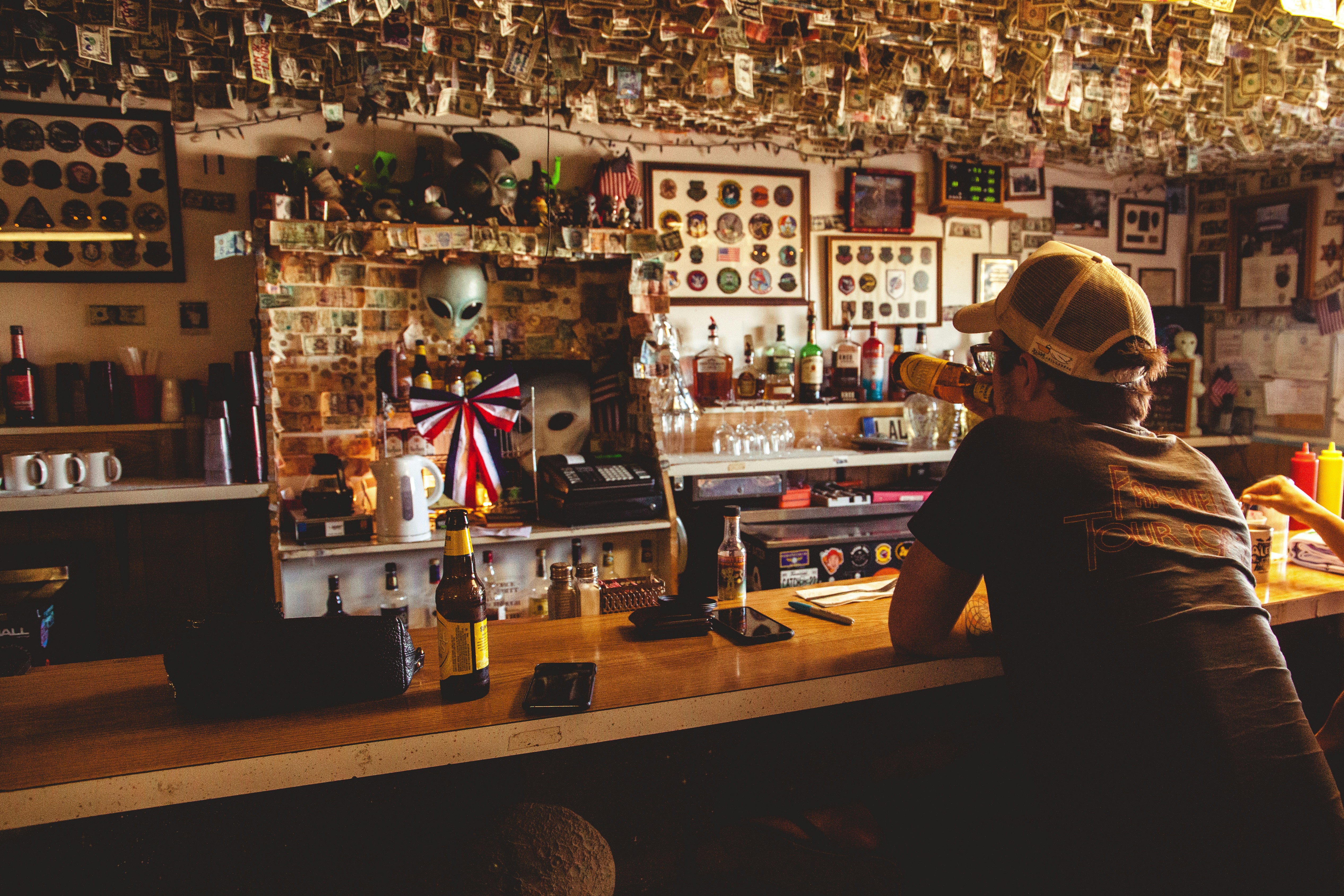
Rachel, Nevada, the nearest town to the featured Area 51 / Rachel, Nevada location, is home to fewer than a hundred residents and one well-known landmark, the Little A'Le'Inn, a bar, restaurant, and motel that has become the unofficial welcome center for curious travelers. Its residents live alongside a steady flow of visitors, and it's best practice to keep noise down, pack out everything you bring, and leave no trace. Route 375 was officially designated the Extraterrestrial Highway by the state of Nevada in 1996, and the Travel Nevada tourism office promotes the drive as a scenic backcountry route.
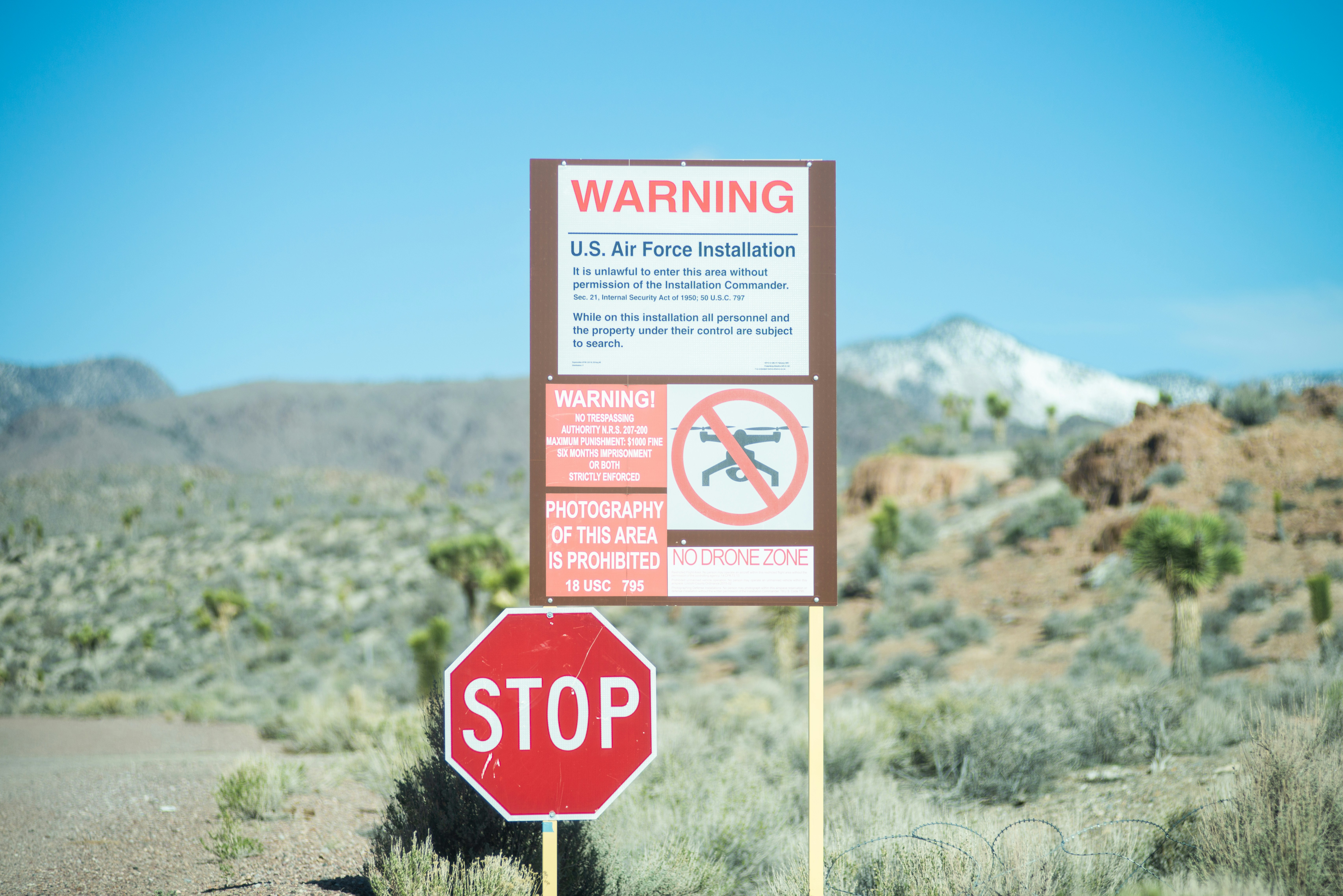
The area many visitors seek is the back gate and the guarded boundary road that leads toward it. The boundary is marked by orange posts and signs warning that photography is prohibited and that the use of deadly force is authorized. Camouflaged security personnel, known locally as the "cammo dudes," monitor the perimeter, and crossing the line will result in detention and prosecution. Public land ends at those signs.
Travel Tips
This is remote country.
- Fuel up before you commit. Fill your tank in Las Vegas, Alamo, or Ash Springs before turning onto Route 375. There is no reliable fuel along the highway itself, and distances between services run to many tens of miles.
- Expect no cell service. Coverage across most of Route 375 ranges from spotty to nonexistent. A phone is not a reliable tool for navigation or emergencies here.
- Download offline maps before you leave a coverage area. Save the full route and your intended stops.
- Watch for open-range cattle, especially at night. Livestock roam freely across unfenced highway here. A cow on the road after dark is a serious hazard, and it's best practice to slow down at dusk and after.
- Plan for the weather. Summer daytime temperatures in the Nevada desert can be extreme, and winter nights drop below freezing. Sudden storms can flood dips in the road.
- Carry water and emergency supplies. Bring far more water than you think you need, plus food, a spare tire, and basic tools. If you break down, you may wait a long time for another vehicle.
- Photography rules. The desert, the highway, the town, and the signs can all be photographed from the public side. Photographing the restricted zone, by camera or by drone, is prohibited.
Photography Opportunities
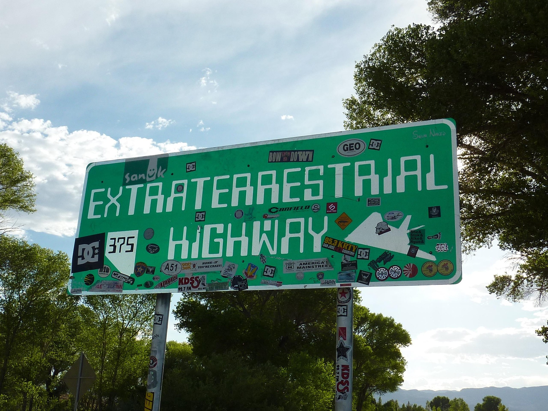
The Extraterrestrial Highway sign is the classic portrait. The black mailbox area has long been a pilgrimage marker along the route, though the mailbox itself is painted white now. The Little A'Le'Inn in Rachel is roadside Americana built around the legend. Sunrise and sunset across the open basin give the best light. At night, the basin is far from any city glow.
Sample Itineraries
Day trip. Leave Las Vegas early. Drive north via US-93 to the southern end of Route 375. Photograph the Extraterrestrial Highway sign, continue to Rachel for a meal at the Little A'Le'Inn, view the boundary signage from the public road, and return the same day. Budget 6 to 8 hours of driving and stops.
Longer day or overnight. Add the full length of the highway, unhurried photography, a stargazing session after dark, and if you want the desert to yourself in the morning, a stay in Rachel or a nearby town. An overnight trades the long round-trip drive for the place at its quietest.
Nearby places
If you are building a longer Nevada itinerary, browse the Mystery Map to plot additional stops across the region, or explore the wider Archive for other classified-history and folklore sites. The Rachel corridor pairs naturally with a slower desert route. If you have already made the drive, the Area 51 / Rachel, Nevada entry takes photos and notes, so the next person arrives prepared.
Past the last sign, the base stays where it has been since 1955, out of sight behind a low ridge to the southwest.
Featured Places
Comments
0 on the record
- No comments yet. Be the first witness.